Annotated Map of the Route between Caoping and Wolongguan
Item
-
Title
-
Annotated Map of the Route between Caoping and Wolongguan
-
Identifier
-
MAP_012
-
Description
-
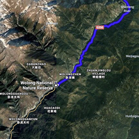
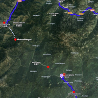
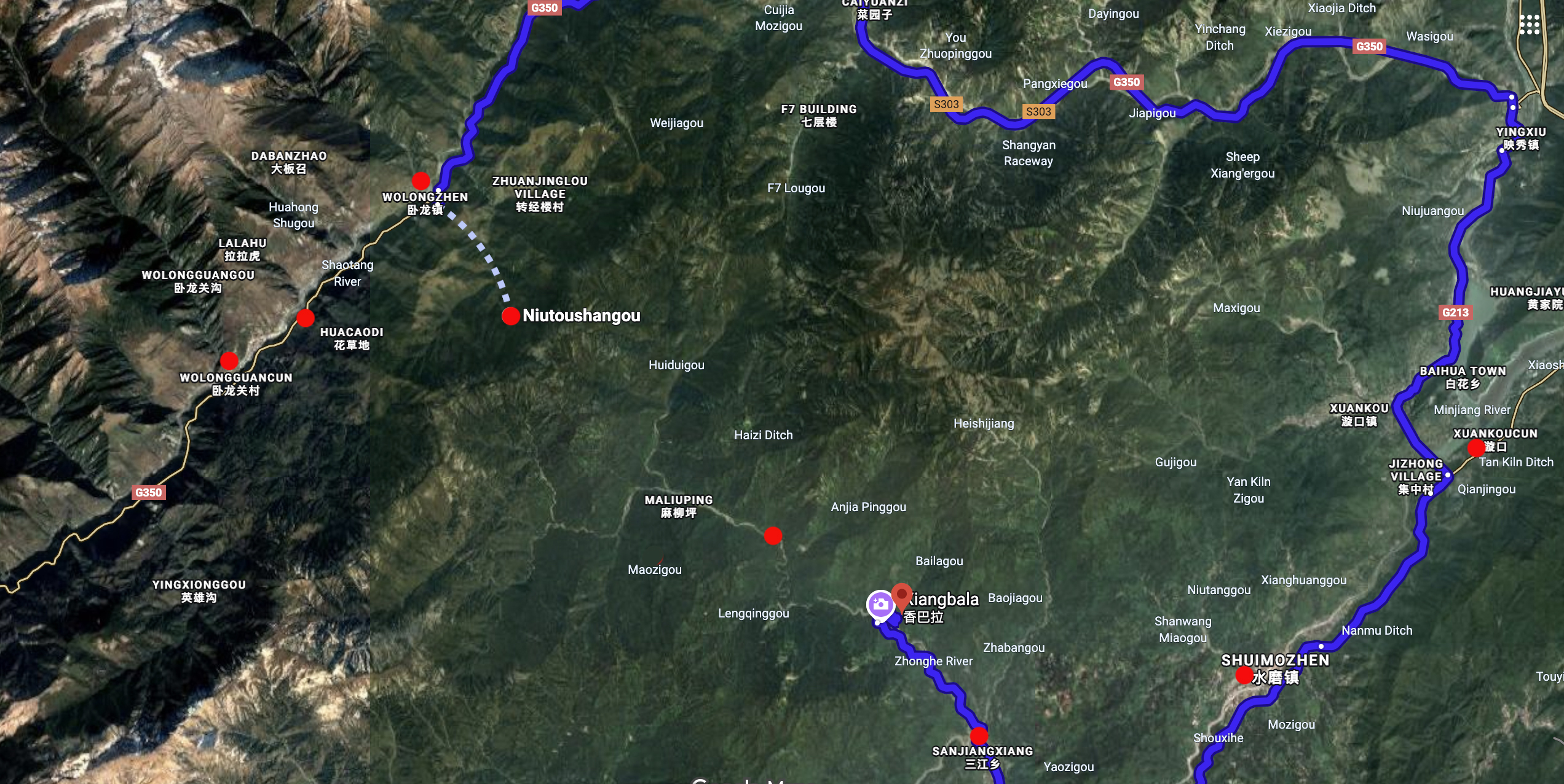
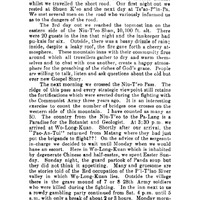
This map's annotations show the key locations mentioned by Beatty in the third and fourth days of his account of his and Gilbert Vinden's trip into tribes country in 1938. Starting at Caoping on the third day, the pair left the riverbed to cross over mountains. They went through Maoshuizi (Mao Shin Tze - the red dot in the middle of the mountains), across the "Cow's Head Pass," and on to Wolongguan by the fourth day.
-
Commentary
-
There is no road today that covers this overland walking route that was in use during the 1920s and 1930s when Helde, Beatty and Vinden recorded it. Therefore the Google Maps shows a different route by foot and highway that could be taken today. According to Helde's map, it appears the land route went from Niutoushangou (Niu T’eo or Shan Cow’s Head Pass) to Huachaodi, rather than to Wolongzhen, as shown. Caoping on this map is at "Xiangbala."
-
Creator
-
Annotations by Cory Willmott
-
Date Created
-
2025-12-30
-
Original Format
-
Google Maps
-
Provenance
-
Original research.
-
Publisher
-
SIUE
-
Record Date
-
2025-12-30
-
Contributor
-
Cory Willmott
-
Type
-
Map
-
References
-
Edward E. Beatty. “The Bandit Chief.” West China Missionary News 40, no. 11 (Nov. 1938): 389-391.
-
Published In
-
George G. Helde. “Map of Part of Tribes Country.” The Journal of the West China Border Research Society 1 (1922-1923): oversize insert.
 WCMN The Bandit Chief, 1938