Annotated Map of Tribal Regions in Sichuan's Southwest, 1920
Item
-
Title
-
Annotated Map of Tribal Regions in Sichuan's Southwest, 1920
-
Caption
-
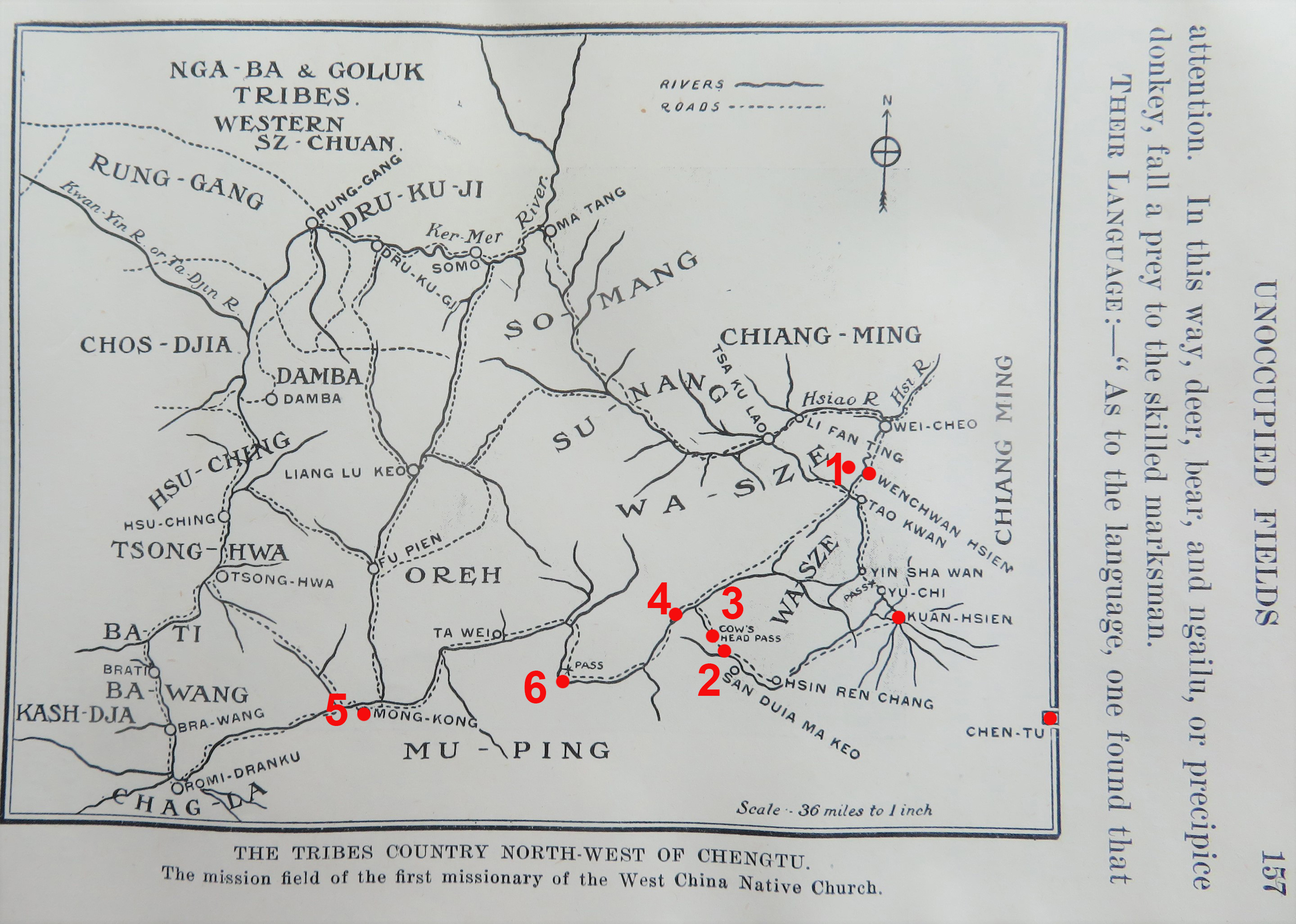
The Tribes Country Southwest of Chengtu
-
Identifier
-
MAP_007
-
Description
-
The map shows tribal territories in Western Sichuan as missionaries understood them before 1920. The portions labelled "Wasze" are where Wassu hunters were successful in capturing live baby pandas for foreign buyers, including David Crockett Graham, Frank Dickinson, Walter Small, Daniel Dye and others.
-
Commentary
-
In addition to a few major cities for orientation, the annotated locations are as follows:
1. Caopoxiang (T’ao Pai or Chaopo)
2. Maoshuizi (Mao Shin Tze)
3. Niutoushangou (Niu T’eo or Shan Cow’s Head Pass)
4. Wolongguan (Wo Long Kuan)
5. Meixing (Mowkung)
6. Dengsheng (Tenseng, at Pa Lang Pass)
-
Creator
-
Annotations by Cory Willmott
-
Date Created
-
1920
-
Original Format
-
Printed in book.
-
Provenance
-
Willmott Family Archives
-
Publisher
-
SIUE
-
Record Date
-
2025-12-30
-
Contributor
-
Cory Willmott
-
Type
-
Map
-
Published In
-
Frederick Clarke Stephenson, ed. Our West China Mission. Toronto: The Missionary Society of the Methodist Church, Young People’s Forward Movement, 1920