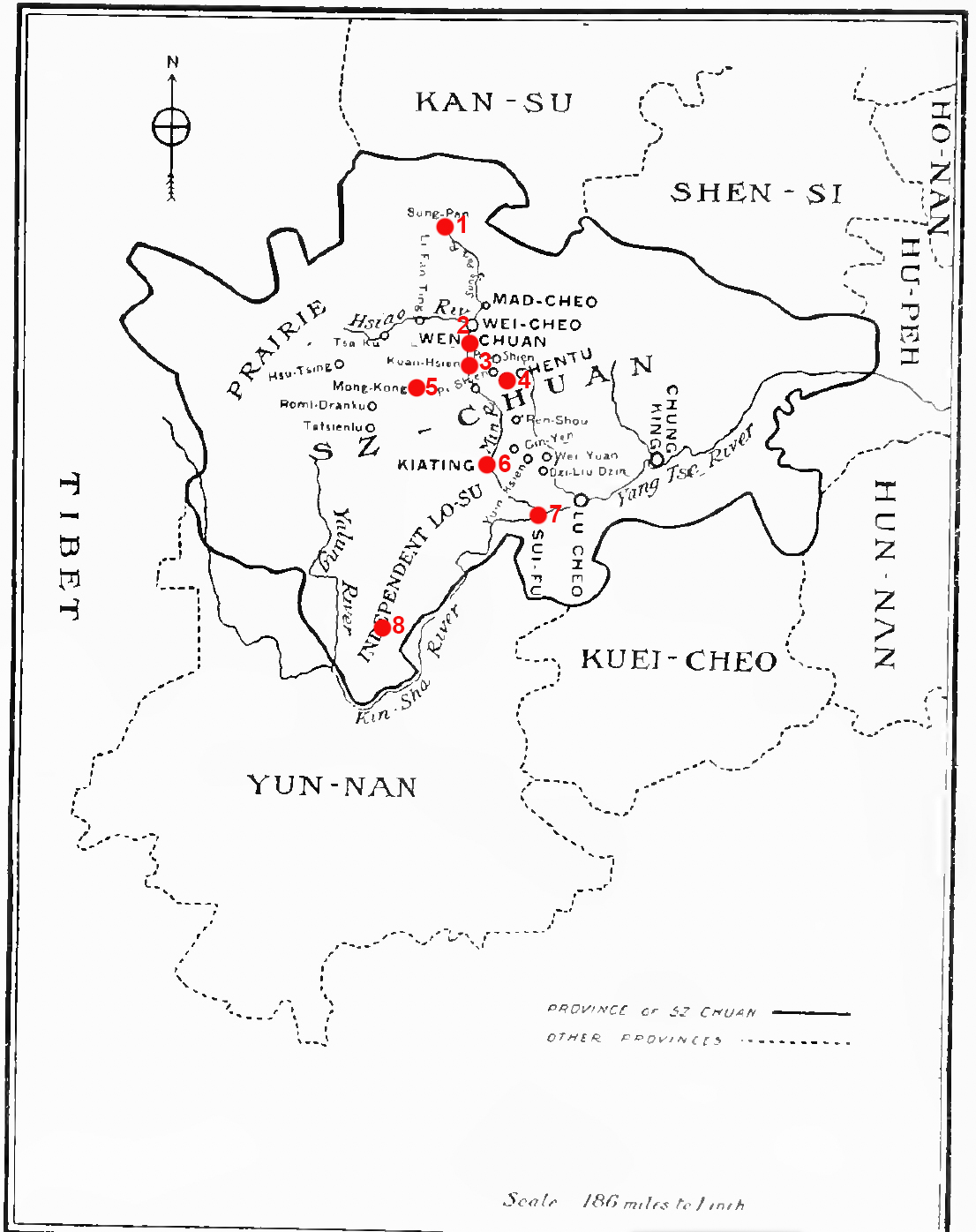
Annotated Map of West China, 1920
Item
-
Title
-
Annotated Map of West China, 1920
-
Caption
-
China's Great West
-
Identifier
-
MAP_005
-
Description
-
This map of the mission stations in West China in 1920 has been annotated to illustrate key locations in panda hunting territories, which stretch from Songpan in the North to Xichang in the south. Key cities are also included for orientation.
-
Commentary
-
Annotated locations as follows:
1. Songpan
2. Miansi (Wenchuan)
3. Dujiangyan (Kuanhsien)
4. Chengdu (Chengtu)
5. Meixing (Mowkung)
6. Leshan (Kiating)
7. Yibin (Suifu)
8. Xichang (Ningyuenfu)
-
Creator
-
Annotations by Cory Willmott
-
Date Created
-
1920
-
Original Format
-
Printed in book.
-
Provenance
-
Willmott Family Archives
-
Publisher
-
SIUE
-
Record Date
-
2025-12-30
-
Contributor
-
Cory Willmott
-
Type
-
Map
-
References
-
Graham, David Crockett. “How the Baby Pandas Were Captured.” Animal Kingdom 45, no. 1 (1942): 19-23.
-
Published In
-
Frederick Clarke Stephenson, ed. Our West China Mission. Toronto: The Missionary Society of the Methodist Church, Young People’s Forward Movement, 1920, p. 66